
Combining Two Record Lots With a Subdivision Survey
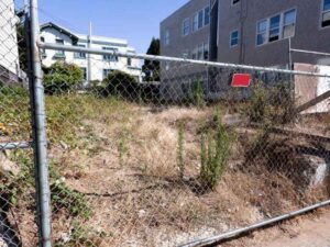
Picture two lots sitting side by side under one owner. You want to build one home, one addition, or one small building that spans both of them. The old line between the lots can get in the way of that plan. A subdivision survey is how most owners clear that line and turn two lots into one. Start it early, since the survey and approval steps often take longer than people expect.
Why Two Record Lots May Need a Subdivision Survey
A record lot is a lot shown on a plat that has been filed with the local land records office. A subdivision survey is a survey that creates, changes, or joins lots and ends with a new plat for recording. It can sound strange to use a “subdivision” survey to combine land. In many places, any change to recorded lot lines goes through the same plat process, whether you split a lot or merge two.
That interior line matters more than most owners think. Setback rules apply to every lot line, so a building can’t cross it without a fix. Lenders and title companies may also want one clean parcel before they sign off on a loan or policy.
Common Reasons Owners Combine Lots
- A new house or addition won’t fit on one lot alone.
- A business wants one site for parking, access, and building space.
- An owner wants to clean up an old layout before selling.
- A builder needs one lot to meet size or frontage rules.
Confirming Existing Lot Lines and Recorded Parcel Information
The first job is to prove where both lots are today. Your surveyor pulls deeds, old plats, and tax maps for each lot. Then the crew goes to the site to find corner markers and measure what’s really there. Those field notes get checked against the records line by line.
This step often turns up small problems. Deed sizes may not match the plat. A tax lot may not line up with the record lot, which can confuse buyers and lenders. There may even be a thin gap or overlap between the two lots that no one noticed for years.
These issues need to be sorted out before a new plat is drawn. A combined lot built on bad records carries the same errors forward. Ask your surveyor to flag anything that looks off, and share any old surveys or title papers you have.
Reviewing Easements and Improvements Across Both Lots
An easement is a right that lets someone else use part of your land for a set purpose. Utility lines, drainage paths, and shared driveways are common examples. Easements often run along lot lines, so the line you want to remove may have one sitting right on it. In most cases, joining the lots doesn’t erase the easement. It stays until the party that holds it agrees to release or move it.
Your surveyor will also map what’s built on the land. That includes buildings, sheds, fences, walls, driveways, and utility boxes. Anything that crosses the old line or pushes past the outer lines should show up on the survey. Neighbor fences or structures that creep onto your land matter too.
Take this part seriously. A sewer line under your planned footprint can change your whole design. So can a fence that sits two feet off the true line. It’s much cheaper to learn this now than after plans are drawn.
Preparing the Combined Lot for Future Site Planning
Once the lots are joined, the numbers change. The new lot will have a new area, new frontage, and new setback lines. Your designer needs those numbers to plan a building that fits the rules. Zoning limits can vary by property type and jurisdiction, so confirm them before design gets too far along.
This is a good time to think past the plat. Many projects also need a topographic survey, which shows ground shape, slopes, and drainage. Utility locations help too, since water, sewer, and power tie-ins affect where a building can go. If there’s any chance of flood risk, ask whether flood zone data should be added.
One clean base map saves time later. Architects, engineers, and contractors all work from the same drawing. That cuts down on mix-ups and redraws once permits and construction begin.
Coordinating Survey Documents With the Approval Process
The new plat has to be reviewed before it’s recorded. The reviewing office may check the format, the math, the legal description, and whether the lot meets local rules. It’s common to get comments back and make a round of changes. How long this takes can vary by municipality, county, and project scope.
Paperwork goes beyond the drawing. All owners usually need to sign the plat. If either lot has a mortgage, the lender may need to agree to the change. Your title company may also want to see the recorded plat before it updates any policy.
Plan around these steps. If a closing, permit, or build date depends on the new lot, tell your surveyor right away. Rules and forms can differ from place to place, so check with the local review office and your attorney for anything that touches legal rights.
For a free land surveying quote, call us at (202) 471-1342 or send us a message by going here.
Posted in land surveying, land surveyor | Tagged cost of land surveying, estimating the cost of land surveying, land surveying cost, land surveying cost Washington DC
